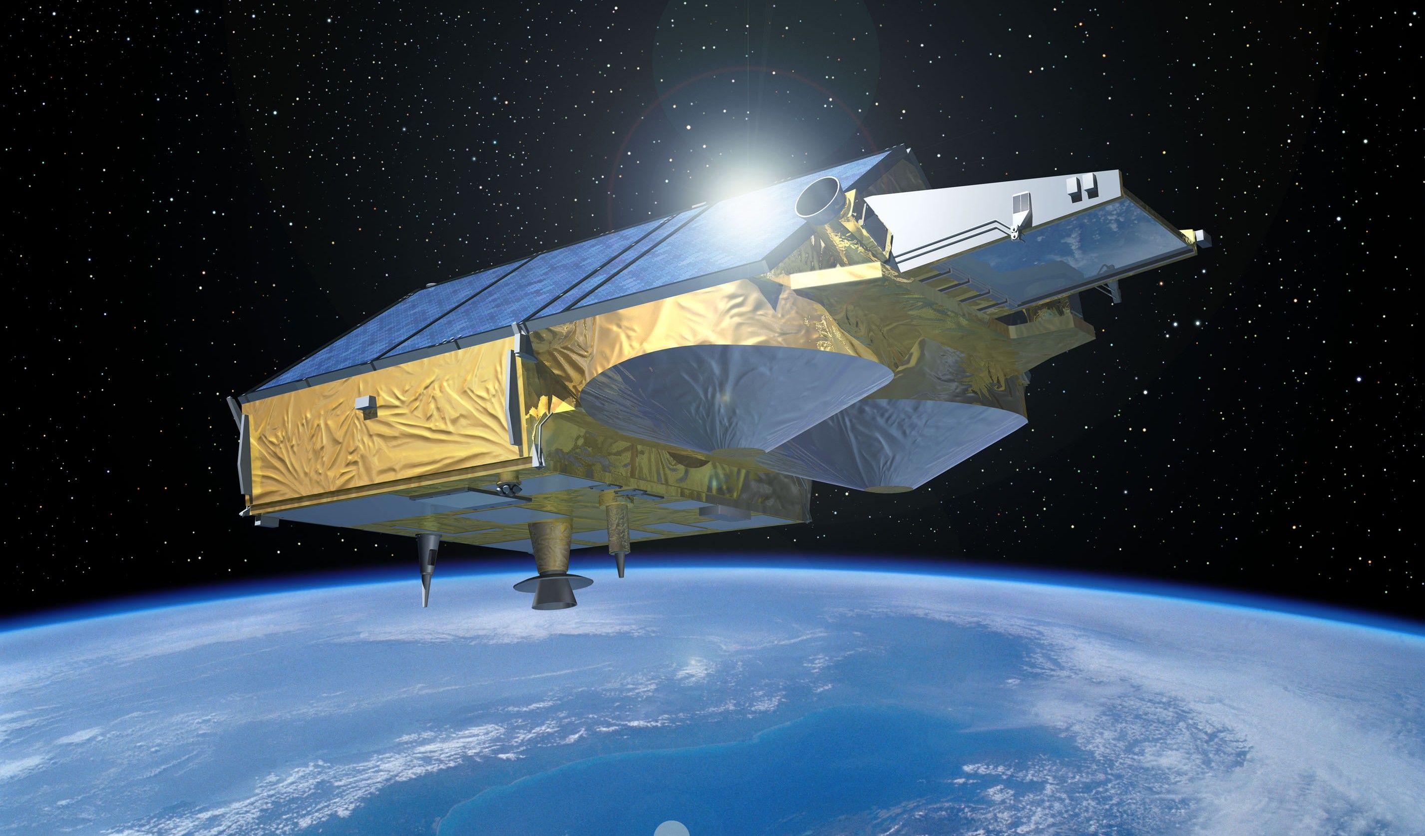
 Render of the CryoSat-2 satellite © European Space Agency
The CryoSat-2 satellite, launched by the European Space Agency (ESA), has been measuring changes in the planet’s ice and snow for fifteen years. Initially designed to last three years, this mission has provided crucial data for monitoring the impacts of climate change on Arctic and continental ice sheet thickness, as well as the study of Antarctica and global oceanography.
The main payload of CryoSat-2 is a radar sensor that measures the elevation of the Earth’s surface; it is an interferometric synthetic aperture radar altimeter (SIRAL). To estimate the thickness of ice sheets or surface snow, the sensor sends a radar signal to the Earth, and calculates the time it takes for it to be bounced back to the satellite.
“Astonishlingly, CryoSat is still operational after 15 years, almost as long as ESA’s record-holder, ERS-2, which lasted 16 years”, explains Richard Francis, former ESA’s CryoSat-2 Project Manager.
“CryoSat’s science requirements were for a 2-year lifetime, and we ensured it had consumables for one further year”, affirms Francis. Despite some failures in orbit, notably in the power control unit and a leaky thruster, CryoSat is still working with full performance, thanks to its back-up systems.
“This is a great credit to all involved: the engineering team who built it, led by Airbus Defence and Space in Friedrichshafen, in cooperation with my team at ESTEC in the Netherlands. Controlling it from ESOC in Darmstadt, the ESA operations team monitor work together with the management team at ESRIN, Frascati, in charge of the mission since the end of its 6-month commissioning phase.”
isardSAT, leading the external calibration of CryoSat-2
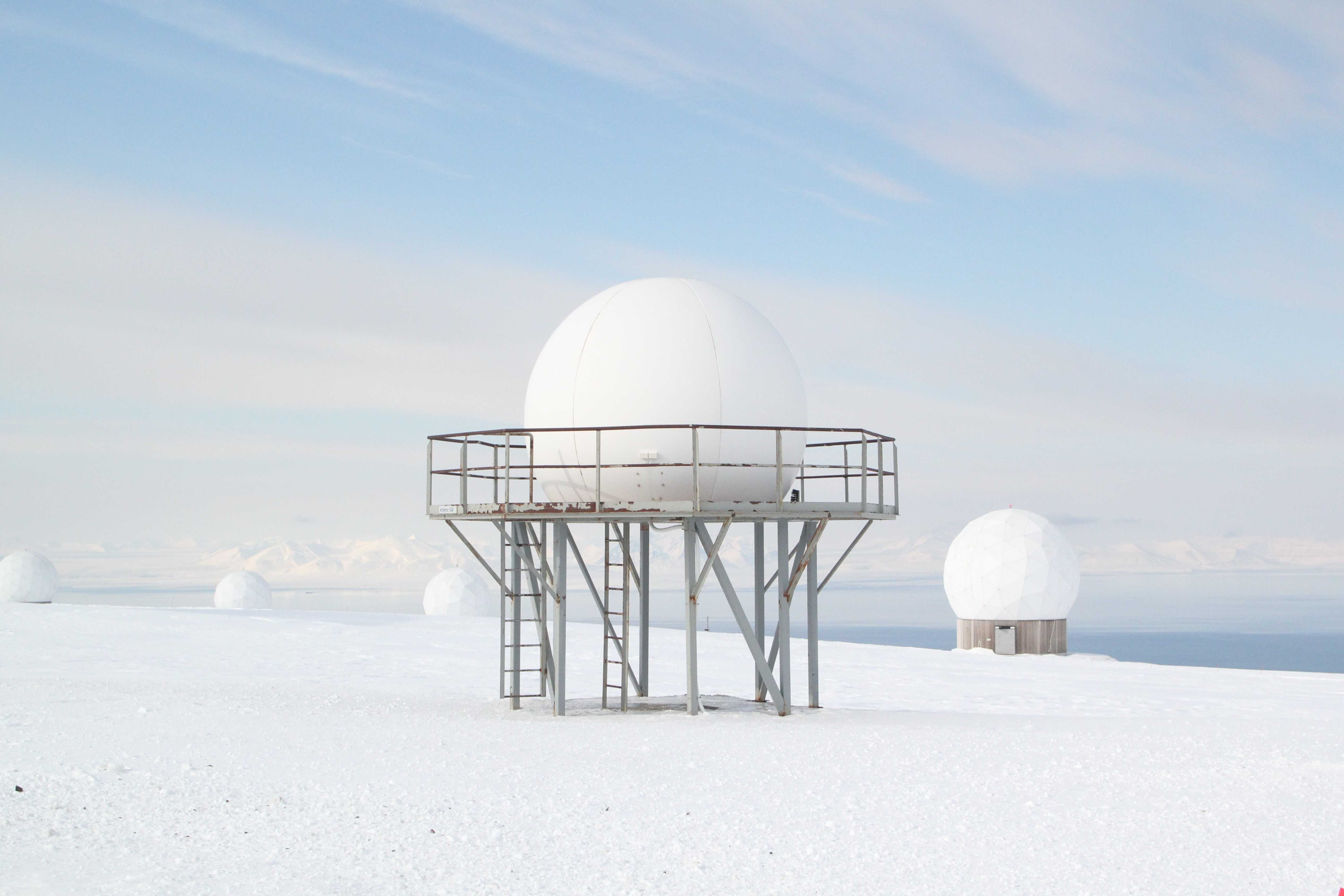 CryoSat-2 calibration station in Svalbard, Norway. The radome that protects the transponder for calibrating the satellite is visible In the foreground,. © isardSAT
isardSAT has led the external calibration of the satellite since its launch. “Like any advanced data processing, the SIRAL sensor needs periodic calibration to verify that it is working correctly,” explains Mònica Roca i Aparici, director of isardSAT. A process that is achieved by having the instrument measure a known target. “We process and analyze the measurements of the satellite when it passes over strategically placed devices, called transponders, in known locations and with specific characteristics,” adds the engineer.
isardSAT has participated in several satellite calibration campaigns, processing data from European Space Agency transponders placed in Svalbard (Norway), Crete and Gavdos (Greece).
15 years providing key data to the research on climate change
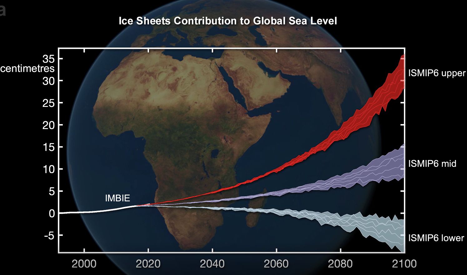 Ice sheets contribution to the rise of global sea level, according to the IMBIE 2023 report, based on data from CryoSat-2 © IMBIE.
The data series collected over the years have allowed and will allow to understand how climate change is diminishing polar ice caps and glaciers, in addition to providing information on oceans and coastal dynamics.
isardSAT has developed algorithms to process the satellite data and apply them in different international research projects. Some examples are:
- IMBIE, a collaboration of different scientific organizations to estimate the mass loss of the Antarctic and Greenland ice sheets. More information.
- CryoSat+ Mountain Glaciers, a project dedicated to improving the measurements of changes in glacier thickness, and determining the balance between the mass of the ice and its contribution to sea level. More information.
- CryoTop Evolution, a project aimed at studying the state of the Antarctic and Greenland ice sheets through the swath interferometry technique. More information.